Create a RasterBrick of GOES data
goesaodc_createRaster.RdCreate a RasterBrick of GOES AOD data including data points with the specified resolution and function, and within the specified bounding box and data quality flag level.
The dqfLevel parameter can take a value of:
0 -- High quality retrieval flag
1 -- Medium quality retrieval flag
2 -- Low quality retrieval flag
3 -- No retrieval quality flag
The bbox parameter can be a vector of floats in c(lonLo, lonHi, latLo,
latHi) order or the return value from sp::bbox() or
raster::extent().
goesaodc_createRaster(
  nc = NULL,
  res = 0.1,
  fun = mean,
  bbox = bbox_CONUS,
  dqfLevel = NULL
)
Arguments
| nc | ncdf4 handle |
|---|---|
| res | resolution of raster in degrees |
| fun | function to use when rasterizing |
| bbox | Bounding box for the region of interest. |
| dqfLevel | Data quality flag level. |
Value
RasterBrick
Examples
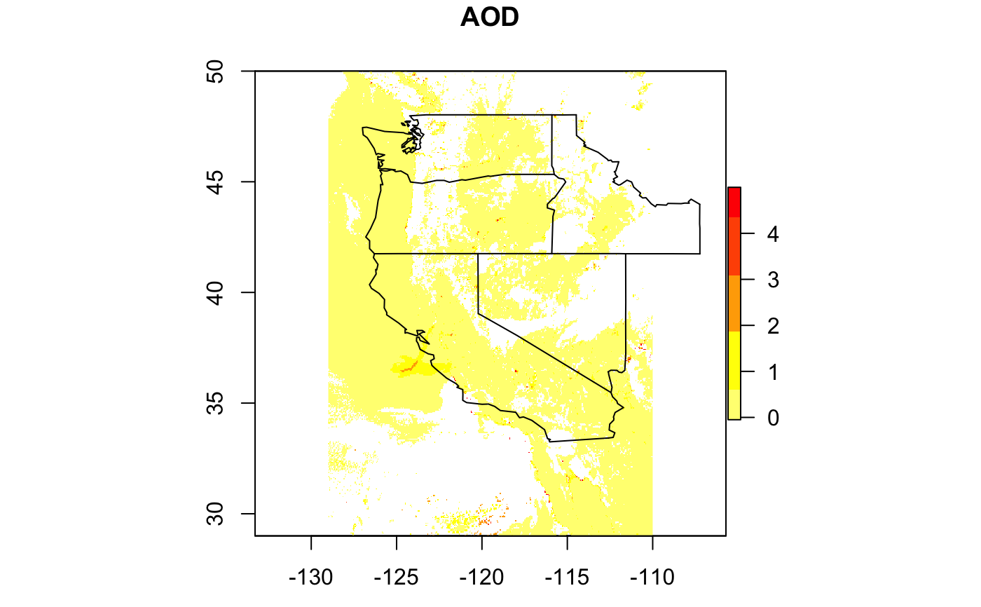
# \donttest{ library(MazamaSatelliteUtils) setSatelliteDataDir("~/Data/Satellite") goesaodc_downloadAOD( satID = "G17", datetime = "2019-10-27 16", timezone = "UTC", verbose = TRUE ) netCDF <- "OR_ABI-L2-AODC-M6_G17_s20193001616196_e20193001618569_c20193001621030.nc" nc <- goesaodc_openFile(netCDF) bbox <- c(-129, -110, 29, 50) rstr <- goesaodc_createRaster( nc, res = 0.05, dqfLevel = 3, bbox = bbox ) west <- c("washington", "oregon", "california", "nevada", "idaho") maps::map(database = "state", regions = west)# }